Missouri River Flood Information System
A project of the Iowa Flood Center
The 2019 floods in Iowa led to 80 counties receiving FEMA disaster declarations, and USDA crop insurance payments from excess precipitation totaled over $210 million. Areas along the Missouri and Mississippi Rivers were hardest hit following an unprecedented 12+ months of above-normal rainfall followed by extreme cold Polar Vortex conditions, a snowy winter, a bomb cyclone, snow melt, levee failures, and ice jams that led to massive, record-shattering flooding. Along the Missouri River, areas that had never been flooded were left devastated, with nearly 3,000 individuals and 500 businesses impacted. Following the 2019 floods, it became clear that the region needed long-term, comprehensive resiliency planning.
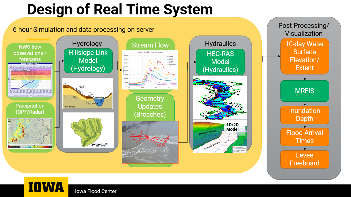
This work presents the development of an operational flood forecasting system for the Missouri River watershed along Nebraska and Iowa and into Missouri. The forecasting system couples a hydrological and a hydraulic model along with forecasted rainfall at a scale that allows for timely flood information at five cities and multiple towns in the area. The hydrological model uses a landscape decomposition closely following the region’s observed channels, while the hydraulic model uses high-definition topography and bathymetry. We validated the system with the 2019 flood event and recreated the 2011 and 2016 events. We present the modeling results and the forecasts on a web platform where users can observe the forecasted floodplains along the main channel and the flood potential of every river in the area.

In this project I worked in the development, setup, and validation of the hydrological model.